Popular Posts

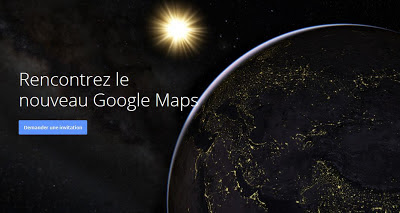
Nouvelle interface Google Maps (Lance la semaine prochaine) .

samedi 18 mai 2013


la semaine prochaine

Soyez parmi les premiers à essayer la nouvelle version de Google Maps. 
Google s'apprête à lancer une nouvelle interface pour Google Maps. La mise à jour supprime la barre latérale et affichera tout en haut de la carte en plein écran.Une des nouvelles fonctionnalités vous permet de restreindre les résultats de recherche locale pour les endroits recommandés par les meilleurs commentaires ou de vos cercles Google+.

Google Maps: Into the Future

Source

Top 8 des images satellites (un peu effrayantes) de notre planète en time-lapse

jeudi 16 mai 2013


« Une image vaut mille mots » disait Confucius. Ca pète pour commencer une intro, mais c’est aussi sûrement ce que se sont dits les gens de chez Google pour le projet « Timelapse » qu’ils viennent de lancer. L’idée ? Utiliser les images satellites des 28 dernières années pour montrer les impacts de notre développement sur la planète Terre. C’est passionnant … mais un peu effrayant.
  1. L’assèchement du Lac d’Ourmia (Iran)
    Lake Urmia Drying Up
    Crédits photo : Google
  2. Déforestation de l’Amazonie (Brésil)
    Brazilian Amazon Deforestation
    Crédits photo : Google
  3. Recul du Glacier Columbia (Alaska, Etats-Unis)
    Columbia Glacier Retreat
    Crédits photo : Google
  4. L’Expansion urbaine de Dubai (Émirats arabes unis)
    Dubai Coastal Expansion
    Crédits photo : Google
  5. Le développement de l’irrigation (Arabie Saoudite)
    Saudi Arabia Irrigation
    Crédits photo : Google
  6. L’exploitation d’une Mine de charbon (Wyoming, Etats-Unis)
    Wyoming Coal Mining
    Crédits photo : Google
  7. L’Expansion urbaine de Las Vegas … et l’assèchement du Lac Mead (Nevada, Etats-Unis)
    Las Vegas Urban Growth
    Crédits photo : Google
  8. L’assèchement de la Mer d’Aral (Kazakhstan)
Source : Google Earth Engine (via Konbini)

Rapport de TP ENVI

dimanche 12 mai 2013


Rapport de TP ENVI 
Registration DEM Extractiion
Classification
Classification " Decision Tree "


Les Régions du Nord du Maroc Etat des lieux territorial

Les Régions du Nord du 
Maroc 
Etat des lieux territorial 
Démographie, économie, secteurs sociaux, 

lien

ERDAS IMAGINE 9.2 + LPS + pro 600

vendredi 10 mai 2013


ERDAS IMAGINE 9.2 | 1.40GB / 5x200MB

ERDAS IMAGINE, le premier système de création de données géospatiales dans le monde, intègre géospatiale traitement de l'image et de l'analyse, de la télédétection et des fonctionnalités SIG dans un package pratique puissant. Il vous permet de créer facilement des produits à valeur ajoutée tels que des images 2D, orthophotographie mosaïques, landcover classification, Films 3D flythrough, vecteurs dérivés de l'imagerie et des compositions de plan cartographique de qualité de données géospatiales.

ERDAS IMAGINE  + LPS

Mediafire


Pro600 sur commande

uploaded by : mhamda

Autodesk Infrastructure Modeler for transportation projects

mercredi 8 mai 2013


Wesley Newman en revue les principes fondamentaux d'Autodesk Infrastructure Modeler. Voir comment démarrer un projet et créer un modèle à partir de diverses sources de données. Esquisser des nouvelles routes ou ferroviaires, ajouter des bâtiments, des zones d'eau et d'autres caractéristiques de votre modèle. Utilisez les styles pour contrôler l'affichage de ces fonctions et de créer des propositions convaincantes. Gérer différents scénarios de conception. Apprendre à partager les propositions de projets avec les autres en utilisant des images ou des vidéos encore. Prenez vos modèles conceptuels dans la conception détaillée de l'interopérabilité avec les applications de conception

SPOT-5 SATELLITE IMAGERY AND SENSOR CHARACTERISTICS

mardi 16 avril 2013

الاســـم: spot-5_in_orbit.jpg
المشاهدات: 2
الحجـــم: 28.5 كيلوبايت


Satellite Imaging Corporation acquires and provides SPOT-5 satellite imagery worldwide.


ABOUT THE SPOT-5 SATELLITE SENSOR

The SPOT-5 Earth observation satellite was successfully placed into orbit by an Ariane 4 from the Guiana Space Centre in Kourou during the night of 3 to 4 May 2002.

The VEGETATION 2 passenger instrument on SPOT-5 also provides continuity of environmental monitoring around the globe, like its predecessor on SPOT-4.

SPOT Image Corporation is composed of four subsidiaries, including an office in Germany and a dense global network of receiving stations, channel partners, and distributors. Satellite Imaging Corporation is an official distributor for SPOT Image Corporation.

Compared to its predecessors, SPOT-5 offers greatly enhanced capabilities, which provide additional cost-effective imaging solutions. Thanks to SPOT-5's improved 5-metre and 2.5-metre resolution and wide imaging swath, which covers 60 x 60 km or 60 km x 120 km in twin-instrument mode, the SPOT-5 satellite provides an ideal balance between high resolution and wide-area coverage. The coverage offered by SPOT-5 is a key asset for applications such as medium-scale mapping (at 1:25 000 and 1:10 000 locally), urban and rural planning, oil and gas exploration, and natural disaster management. SPOT-5's other key feature is the unprecedented acquisition capability of the on-board HRS stereo viewing instrument, which can cover vast areas in a single pass. Stereo pair imagery is vital for applications that call for 3D terrain modeling and computer environments, such as flight simulator databases, pipeline corridors, and mobile phone network planning.

SPOT-5 SATELLITE SENSOR CHARACTERISTICS

Launch Date May 3, 2002
Launch Vehicle Ariane 4
Launch Location Guiana Space Centre, Kourou, French Guyana
Orbital Altitude 822 kilometers
Orbital Inclination 98.7°, sun-synchronous
Speed 7.4 Km/second (26,640 Km/hour)
Equator Crossing Time 10:30 AM (descending node)
Orbit Time 101.4 minutes
Revisit Time 2-3 days, depending on latitude
Swath Width 60 Km x 60 Km to 80 Km at nadir
Metric Accuracy < 50m horizontal position accuracy (CE90%)
Digitization 8 bits
Resolution
Pan: 2.5m from 2 x 5m scenes

Pan: 5m (nadir)

MS: 10m (nadir)

SWI: 20m (nadir)

Image Bands
Pan: 480-710 nm

Green: 500-590 nm

Red: 610-680 nm

Near IR: 780-890 nm

Shortwave IR: 1,580-1,750 nm

ARCHIVED AND NEW SPOT-5 IMAGERY

For many image requests, a matching image can already be located in the archives of SPOT-5 imagery from around the world. If no image data is available in the archives, new SPOT-5 satellite image data can be acquired through a satellite tasking process. Besides providing image data, Satellite Imaging Corporation also performs many tasks in the background to ensure that we meet customer specifications and time schedules. We:

Negotiate the attainment of archived or new images
Process imagery, including orthorectification, DSMs, DTMs, and culture and terrain extraction for GIS
Incorporate third-party United States and international GIS data
Consult on band combinations most appropriate to bring out the geographical and manmade features that are most relevant to your project
Perform spectral analysis for landcover use classifications and environmental changes
For more information and pricing, please contact us.

Cours ENVI 4.8

lundi 11 mars 2013

MATLAB 2010a


MATLAB 2010a  | 2.8GB 

 MATLAB pour le calcul scientifique 
et technique, et Simulink, 
plateforme de simulation multi-domaines.


uploaded by : mhamda

esri arcgis 10.1

dimanche 6 janvier 2013


esri arcgis 10.1 | 3.8GB 

Que vous souhaitiez réaliser une analyse spatiale, gérer des volumes importants de données géographiques ou créer des cartes pertinentes s’intégrant dans un processus d’aide à la décision, la plate-forme ArcGIS est la solution à tous vos besoins SIG


Name: esri arcgis 9.3
Version: 9.3 32bit & 64bit
Creator: http://www.esrifrance.fr
Interface: english
OS: Windows XP / Vista / Seven


uploaded by : mhamda
 
Support : Creating Website | Johny Template | Mas Template
Copyright © 2011. cartographie - All Rights Reserved
Template Created by Creating Website Inspired by Sportapolis Shape5.com
Proudly powered by Blogger